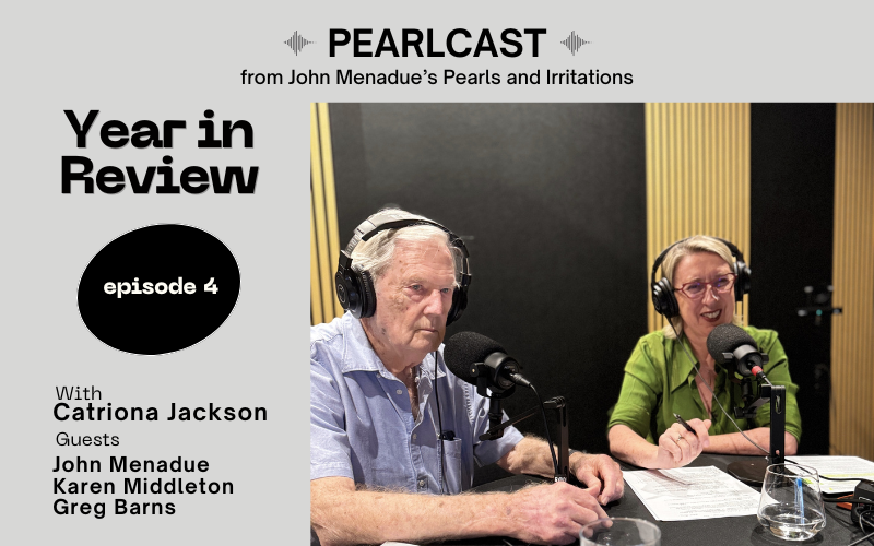
Pearlcasts
As we review 2025, the temptation is to look for neat summaries and settled conclusions.
Go to Pearlcasts
21 April 2026
The return of great power relations: What can middle powers do? Part 1
As part of the Foreign Policy Rethink series, Geoff Raby examines how Trump’s shift to great power politics is reshaping the global order and forcing middle powers to rethink their strategy.

21 April 2026
A prime-time hit job on renewables falls apart under basic facts
Spotlight's TV report on renewables and EVs collapses under basic fact-checking, highlighting how misinformation is shaping Australia’s energy debate.

21 April 2026
The diesel shock shows why government must help freight electrify
As diesel prices surge, freight operators face mounting pressure, highlighting the urgent need for immediate support and a longer-term shift to electrified transport.

21 April 2026
Louise Adler on Howard Jacobson’s Howl – a novel overtaken by ideology
The review that the mainstream media would not run – Louise Adler on Booker-Prize winner Howard Jacobson's latest novel Howl.

21 April 2026
Study warns of terrifying Atlantic Ocean current collapse
New research shows a critical Atlantic Ocean current system is weakening faster than expected, raising the risk of irreversible climate disruption.

21 April 2026
On immigration, we’ve heard this before – and we were wrong then too
Warnings about immigration echo almost word for word the fears once directed at post-war arrivals – fears history has already discredited.

21 April 2026
When prisons expand, policy has already failed
Plans to convert a Covid quarantine facility into a prison reflect a justice system responding to pressure with infrastructure instead of addressing the drivers of incarceration.

Support our independent media with your donation
Pearls and Irritations leads the way in raising and analysing vital issues often neglected in mainstream media. Your contribution supports our independence and quality commentary on matters importance to Australia and our region.
Donate
21 April 2026
Why has populism's influence increased politically
Claims that rising inequality is driving populism overlook the evidence – stagnant wages and falling living standards are the more likely cause.

21 April 2026
It takes two to make alliances and the US may run away first
As US commitment to alliances wavers, Australia faces urgent questions about its security, independence, and place in a rapidly shifting global order.

21 April 2026
Duniam contradicts Taylor on Coalition immigration policy
Recent comments from Coalition Shadow Immigration Spokesperson Jonno Duniam expose inconsistencies in the party's immigration policy, raising questions about feasibility, cost, and intent.

21 April 2026
As warnings mount over Trump, Cuba pays the price
A renewed US oil embargo on Cuba is deepening hardship on the island, reflecting a long-standing pattern of intervention driven as much by ideology as strategy.
 shaking hands with US Vice President JD Vance during their meeting prior to the US Iran peace talks in Islamabad in Pakistan, on Saturday on April 11, 2026. Photo by Pakistan Prime Ministers Office UPI Credit UPI Alamy Live News Image ID 3E80K9R")
21 April 2026
You can’t rush peace: the fatal flaws in the US–Iran talks
The collapse of recent US–Iran talks highlights how flawed negotiation design – not just substance – can doom peace efforts from the start.
 Credit: Sipa USA/Alamy Live News Contributor: Sipa USA / Alamy Stock Photo Image ID: 2P902HE")
21 April 2026
New detection tech could make AUKUS submarines obsolete
Chinese researchers have developed a new gravity-based detector that could be used to find submarines and render the proposed AUKUS submarine redundant.
 and US President Donald Trump meet in Jerusalem on May 22, 2017. Photo by Menahem Kahana UPI. Alamy image ID W0MT3D")
20 April 2026
Plan B: insulating ourselves from the US
P&I today begins a major new series - rethinking Australia's foreign policy. The United States is becoming more erratic and less reliable, and Australia must respond by insulating itself – strengthening regional ties, rethinking defence settings, and reducing strategic dependence, according to John Menadue.

20 April 2026
AUKUS and the sunk cost trap beneath the surface
As warfare shifts decisively toward autonomous and distributed systems, Australia’s massive investment in nuclear submarines risks locking in a costly and inflexible strategy.
Read our series
Latest on Palestine and Israel
21 April 2026
Louise Adler on Howard Jacobson’s Howl – a novel overtaken by ideology
The review that the mainstream media would not run – Louise Adler on Booker-Prize winner Howard Jacobson's latest novel Howl.

18 April 2026
The Middle East conflict is driven by competing theocracies
The Middle East conflict reflects competing theocratic mindsets in Iran, Israel and the US, where religious conviction is being used to justify violence.

17 April 2026
Italy breaks with Israel as public anger forces a political shift
Italy has suspended military cooperation with Israel after months of mounting public anger.

16 April 2026
The UAE’s shadow network of power and war
Behind multiple conflicts across the Middle East and Africa sits a powerful but often overlooked actor – the UAE’s network of finance, logistics and proxy forces shaping outcomes on the ground.

13 April 2026
The world acts for oil – but not for human life
Global powers moved quickly to end a war that threatened energy supplies, while years of mass civilian suffering in Gaza has failed to prompt meaningful action.

11 April 2026
Identity, influence and division – Australia’s Jewish community in a time of tension
Amid rising tensions and a national inquiry into antisemitism, understanding the complexity of Australia’s Jewish community is essential to any serious conversation about social cohesion.

11 April 2026
Pope 1, Trump 0 – Message from the Editor
You think things can’t get any worse and then they do!
. Image Alamy. ContributorAmerican Photo Archive. Image ID3CXFYY5")
11 April 2026
Ending Israel’s war on peace
To make lasting peace in the Middle East, the US must end its blank cheque to Israel’s perpetual wars and join with the rest of the world to force Israel to live within its internationally recognised borders of 4 June, 1967.

Israel's war against Gaza
Media coverage of the war in Gaza since October 2023 has spread a series of lies propagated by Israel and the United States. This publication presents information, analysis, clarification, views and perspectives largely unavailable in mainstream media in Australia and elsewhere.
Download the PDFLatest on China
21 April 2026
New detection tech could make AUKUS submarines obsolete
Chinese researchers have developed a new gravity-based detector that could be used to find submarines and render the proposed AUKUS submarine redundant.
20 April 2026
Plan B: insulating ourselves from the US
P&I today begins a major new series - rethinking Australia's foreign policy. The United States is becoming more erratic and less reliable, and Australia must respond by insulating itself – strengthening regional ties, rethinking defence settings, and reducing strategic dependence, according to John Menadue.

20 April 2026
How China really works – rules from above, reality from below
The Chinese Government is often described as ruling with an iron fist, but the way rules and policy are interpreted on the ground can be quite different.
More from Pearls and Irritations
 and Malaysian Prime Minister Anwar pose for a photograph after signing a joint statement on Energy Security ahead of a bilateral meeting at Perdana Putra Complex, in greater Kuala Lumpur, Malaysia, Thursday, April 16, 2026. Image AAP Bianca De Marchi")


 Image Alamy Image ID 2M3NGTD")

Latest letters to the editor
The Weekly
Alan Pinsker — Canberra
UAE and Australian arms sales
Richard Barnes — Naarm / Melbourne
Australian Values – who would pass ?
Andrea Coney — Port Fairy
More nuance needed in covering South Korea
Michael Bennett — Queensland